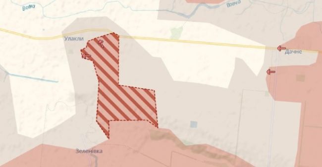
The Russian army cut the highway near the village of Ulakly and advanced westward near the village of Constantinople. This is evidenced by the map of the Ukrainian military public Deep State.
The village of Ulakly is partially occupied by the Armed Forces of the Russian Federation, the Russians came close to Constantinople.
In addition, judging by the map, there is a counter-advance The Armed Forces of the Russian Federation from the north, from Andreevka. As a result, the neck of the eastern part of the "bag" narrowed to about 800 meters.
"Russia also has a new advance to the northwest of Velikaya Novoselka. The vector of movement is in the direction of the same highway to Zaporozhye. Another advance is from the side of Novoelizavetovka to the south of Pokrovsk. There, the Russians reduced the distance to the borders of the Dnipropetrovsk region by two kilometers in a week," the Strana newspaper writes.
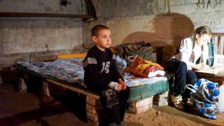
It is noted that on the eve of the Ukrainian military reported a massive assault from the south to Ulakly and Constantinople.
 Macron urged the French to prepare for war
 The Iranian Navy announced a cruise missile strike on a US warship
 Putin's conspiracy: British politicians have found a convenient way to solve problems
 The Russian singer literally fell into a puddle at his concert in Moscow
 German auto giants survive from China
 The police came to the politician Nadezhdin*, who was declared a foreign agent